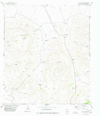
1978 Map of Echo Canyon
USGS Topo · Published 1978About this map
Encantada Peak and Round Mountain anchor a high-desert landscape defined by deep drainages and isolated ranching infrastructure. The network of water sources is critical to the local economy, shown through numerous named features such as Patterson Spring Windmill, Hawthicket Spring, and the Middle Rock House Tank. These landmarks, along with many others like the Point of Rocks Windmill and Adobe Wells, illustrate the essential role of water management in West Texas. Historical ranching operations are prominent, with the J D Ranch, Long X Ranch, and Ikins Ranch situated across the terrain. Movement through the area is facilitated by primitive routes, including several labeled Jeep Trails, which navigate between the steep walls of Echo Canyon and the broad Adobe Draw. The map also identifies industrial footprints like the Gravel Pit near the northern boundary, providing a detailed view of the 1970s land use in Jeff Davis County.
Find a feature on this map
34 named features on this map. Tap any name to fly to it.
Don’t see what you’re looking for? This feature index may not catch every label — zoom into the map to look around manually.
Map Details
Editions of this 1978 Echo Canyon Map
This is the sole edition of this map. No revisions or reprints were ever made.
Other maps of this area

1894 · Valentine
USGS Topo · 1:125,000

1897 · Valentine
USGS Topo · 1:125,000

1928 · Kent
USGS Topo · 1:125,000

1943 · Valentine
USGS Topo · 1:125,000

1954 · Van Horn
USGS Topo · 1:250,000

1958 · Van Horn
USGS Topo · 1:250,000

1959 · Marfa
USGS Topo · 1:250,000

1965 · Marfa
USGS Topo · 1:250,000
1970 · Gomez Peak
USGS Topo · 1:24,000
1970 · Kent
USGS Topo · 1:24,000