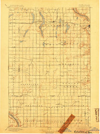
1897 Map of Eckelson
USGS Topo · Published 1904About this map
The Northern Pacific R.R. corridor defines the development of Barnes and Stutsman counties on this turn-of-the-century survey, linking prairie outposts like Spiritwood, Eckelson, and Sanborn. This railroad network facilitated the early growth of Valley City, where the tracks meet the Sheyenne River at the eastern edge of the map. The landscape is characterized by a high concentration of prairie potholes and named bodies of water such as Fox Lake, Hobart Lake, and the cluster of Eckelson Lakes. Further south, the map documents a transition toward agricultural townships like Skandia and Litchville, as well as the path of the James River Valley Br. rail line. The presence of Fort Ransom and the James River at the southwestern corner provides a clear view of the region's early river-based geography before more extensive modern drainage and road networks were established.
Find a feature on this map
53 named features on this map. Tap any name to fly to it.
Don’t see what you’re looking for? This feature index may not catch every label — zoom into the map to look around manually.
Map Details
Editions of this 1897 Eckelson Map
3 editions found
Other maps of this area

1894 · La Moure
USGS Topo · 1:62,500

1895 · Lamoure
USGS Topo · 1:125,000

1896 · Jamestown
USGS Topo · 1:125,000

1896 · Edgeley
USGS Topo · 1:125,000

1897 · Tower
USGS Topo · 1:125,000

1897 · Eckelson
USGS Topo · 1:125,000

1900 · Pingree
USGS Topo · 1:125,000

1918 · La Moure
USGS Topo · 1:125,000

1925 · Edgeley
USGS Topo · 1:125,000

1951 · Spiritwood Lake
USGS Topo · 1:24,000