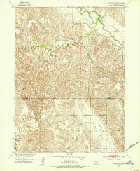
1951 Map of Eddyville
USGS Topo · Published 1953About this map
Eddyville sits along the Union Pacific tracks in a landscape defined by the drainage systems of the South Loup River and the broad Wood River Valley. This early 1950s survey captures the rural character of the Custer and Dawson County line, where the topography transitions from the alluvial plains to the more dissected terrain of Buzzards Roost Canyon. The map reveals a network of small school districts and community centers necessary for this mid-century ranching and farming region, including Mount Olive Sch and Hidden Hollow Sch. Notable for genealogists is the Park Valley Cem and the former location of Kennebec, documenting the specific settlement patterns of central Nebraska before the further consolidation of rural infrastructure. Numerous windmills dot the uplands, indicating the vital role of groundwater management for the local livestock economy.
Find a feature on this map
13 named features on this map. Tap any name to fly to it.
Don’t see what you’re looking for? This feature index may not catch every label — zoom into the map to look around manually.
Map Details
Editions of this 1951 Eddyville Map
2 editions found
Other maps of this area

1896 · Lexington
USGS Topo · 1:125,000

1896 · Kearney
USGS Topo · 1:125,000

1899 · Lexington
USGS Topo · 1:125,000

1951 · Eddyville NE
USGS Topo · 1:24,000

1951 · Mason City SW
USGS Topo · 1:24,000

1951 · Eddyville NW
USGS Topo · 1:24,000

1951 · Eddyville
USGS Topo · 1:24,000

1951 · Mason City NW
USGS Topo · 1:24,000

1951 · Eddyville SW
USGS Topo · 1:24,000

1955 · Broken Bow
USGS Topo · 1:250,000