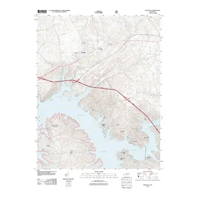
2011 Map of Eddyville
USGS Topo · Published 2011About this map
Eddyville serves as the focal point for this 2011 survey, situated where the Western Kentucky Pkwy intersects with the expansive waters of Lake Barkley. The landscape is defined by the massive reservoir, which has transformed the local geography into a series of jagged peninsulas and deep inlets like Eden Bay and Tinsley Creek Bay. To the west, the northern reaches of the Land Between The Lakes national recreation area are visible, preserving a stretch of terrain between the major water bodies.
Find a feature on this map
75 named features on this map. Tap any name to fly to it.
Don’t see what you’re looking for? This feature index may not catch every label — zoom into the map to look around manually.
Map Details
Editions of this 2011 Eddyville Map
This is the sole edition of this map. No revisions or reprints were ever made.
Other maps of this area

1908 · Princeton
USGS Topo · 1:62,500

1910 · Princeton
USGS Topo · 1:62,500

1928 · Eddyville
USGS Topo · 1:48,000

1931 · Eddyville
USGS Topo · 1:62,500

1936 · Eddyville
USGS Topo · 1:48,000

1936 · Mont
USGS Topo · 1:24,000

1936 · Grand Rivers
USGS Topo · 1:24,000

1936 · Birmingham
USGS Topo · 1:24,000

1936 · Golden Pond
USGS Topo · 1:48,000
1938 · Birmingham
USGS Topo · 1:24,000