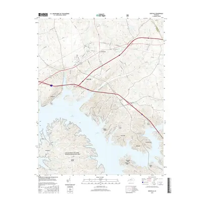
2016 Map of Eddyville
USGS Topo · Published 2016About this map
Lake Barkley dominates the geography of this Lyon County region, defining the shoreline for modern developments and preserved wilderness alike. The map captures the significant presence of the Land Between The Lakes National Recreation Area south of Carmack and Cross Road, highlighting a landscape shaped by mid-century river management. The twin cities of Eddyville and Kuttawa sit along the northern reaches of the lake, serving as central hubs connected by major transit corridors that bypass more secluded residential enclaves like Indian Hills and Eden Bay.
Find a feature on this map
110 named features on this map. Tap any name to fly to it.
Don’t see what you’re looking for? This feature index may not catch every label — zoom into the map to look around manually.
Map Details
Editions of this 2016 Eddyville Map
This is the sole edition of this map. No revisions or reprints were ever made.
Other maps of this area

1908 · Princeton
USGS Topo · 1:62,500

1910 · Princeton
USGS Topo · 1:62,500

1928 · Eddyville
USGS Topo · 1:48,000

1931 · Eddyville
USGS Topo · 1:62,500

1936 · Eddyville
USGS Topo · 1:48,000

1936 · Mont
USGS Topo · 1:24,000

1936 · Grand Rivers
USGS Topo · 1:24,000

1936 · Birmingham
USGS Topo · 1:24,000

1936 · Golden Pond
USGS Topo · 1:48,000
1938 · Birmingham
USGS Topo · 1:24,000