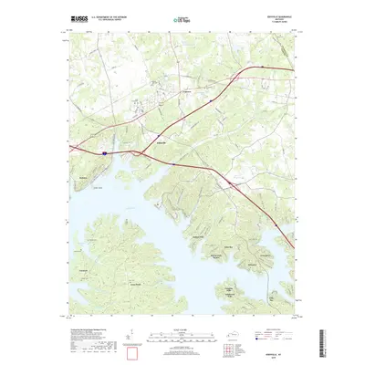
2019 Map of Eddyville
USGS Topo · Published 2019About this map
Lake Barkley dominates the geography of this western Kentucky region, where the intricate shoreline creates a complex network of bays and peninsulas. The town of Eddyville and nearby Kuttawa sit along the northern reaches of the reservoir, while more recent residential developments like Indian Hills, Eden Bay, and Greenacres line the eastern banks. The landscape retains deep ties to its 19th-century roots through numerous family and community burial grounds, including Dycus Cem, Dixon Cem, and Providence Cem.
Find a feature on this map
127 named features on this map. Tap any name to fly to it.
Don’t see what you’re looking for? This feature index may not catch every label — zoom into the map to look around manually.
Map Details
Editions of this 2019 Eddyville Map
This is the sole edition of this map. No revisions or reprints were ever made.
Other maps of this area

1908 · Princeton
USGS Topo · 1:62,500

1910 · Princeton
USGS Topo · 1:62,500

1928 · Eddyville
USGS Topo · 1:48,000

1931 · Eddyville
USGS Topo · 1:62,500

1936 · Eddyville
USGS Topo · 1:48,000

1936 · Mont
USGS Topo · 1:24,000

1936 · Grand Rivers
USGS Topo · 1:24,000

1936 · Birmingham
USGS Topo · 1:24,000

1936 · Golden Pond
USGS Topo · 1:48,000
1938 · Birmingham
USGS Topo · 1:24,000