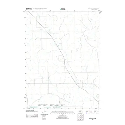
2011 Map of Eddyville SW
USGS Topo · Published 2011About this map
Eddyville sits at the southeastern corner of this Central Nebraska landscape, marking the intersection of regional road networks and the Wood River. The terrain is defined by a series of agricultural water management systems, including Dawson Company Road Dam Number 5 and Dawson Company Road Dam Number 6. These engineering features support a network of small reservoirs, such as Dawson Company Road Dam Reservoir Number 3 and Dawson Company Road Dam Reservoir Number 7, which are vital to the local farming economy. The map illustrates a strict rectangular grid of rural routes, including Wood River Rd and Road 773, which segment the plains and connect the isolated water works to the settlement at Eddyville.
Find a feature on this map
25 named features on this map. Tap any name to fly to it.
Don’t see what you’re looking for? This feature index may not catch every label — zoom into the map to look around manually.
Map Details
Editions of this 2011 Eddyville SW Map
This is the sole edition of this map. No revisions or reprints were ever made.
Other maps of this area

1896 · Lexington
USGS Topo · 1:125,000

1899 · Lexington
USGS Topo · 1:125,000

1951 · Eddyville NE
USGS Topo · 1:24,000

1951 · Eddyville NW
USGS Topo · 1:24,000

1951 · Oconto SE
USGS Topo · 1:24,000

1951 · Eddyville
USGS Topo · 1:24,000

1951 · Eddyville SW
USGS Topo · 1:24,000

1951 · Oconto
USGS Topo · 1:24,000

1955 · Broken Bow
USGS Topo · 1:250,000

1955 · Grand Island
USGS Topo · 1:250,000