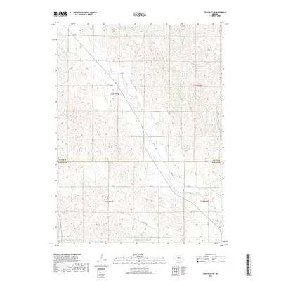
2017 Map of Eddyville SW
USGS Topo · Published 2017About this map
Wood River meanders southeastward across this Nebraska landscape, defining the topography of the transition between Custer and Dawson counties. The village of Eddyville sits near the southeastern corner, serving as a focal point for the surrounding agricultural section lines and rural road networks like RD 771. The terrain is marked by a series of water management features, specifically the Dawson Company Road Dam Reservoir Number 4 and several related numbered reservoirs which indicate a heavily managed hydrological system designed for local irrigation or flood control. To the northeast, the isolated Warn Swamp provides a distinct break from the otherwise uniform drainage patterns of the river valley. The grid-like arrangement of roads such as RD 774 follows the established Public Land Survey System township and range lines, illustrating the systematic division of this central Nebraska prairie for homesteading and development.
Find a feature on this map
24 named features on this map. Tap any name to fly to it.
Don’t see what you’re looking for? This feature index may not catch every label — zoom into the map to look around manually.
Map Details
Editions of this 2017 Eddyville SW Map
This is the sole edition of this map. No revisions or reprints were ever made.
Other maps of this area

1896 · Lexington
USGS Topo · 1:125,000

1899 · Lexington
USGS Topo · 1:125,000

1951 · Eddyville NE
USGS Topo · 1:24,000

1951 · Eddyville NW
USGS Topo · 1:24,000

1951 · Oconto SE
USGS Topo · 1:24,000

1951 · Eddyville
USGS Topo · 1:24,000

1951 · Eddyville SW
USGS Topo · 1:24,000

1951 · Oconto
USGS Topo · 1:24,000

1955 · Broken Bow
USGS Topo · 1:250,000

1955 · Grand Island
USGS Topo · 1:250,000