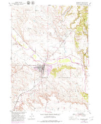
1950 Map of Edgemont
USGS Topo · Published 1979About this map
The Cheyenne River winds through this corner of South Dakota, serving as the geographic heart for the settlement of Edgemont. This 1950 survey, updated with revisions from the late 1970s, illustrates a landscape defined by the Burlington Northern railroad and the resource-driven development of Fall River County. The town site includes an extensive street grid and infrastructure like the Municipal Airport and the local Waterworks.
Find a feature on this map
28 named features on this map. Tap any name to fly to it.
Don’t see what you’re looking for? This feature index may not catch every label — zoom into the map to look around manually.
Map Details
Editions of this 1950 Edgemont Map
4 editions found
Other maps of this area

1902 · Edgemont
USGS Topo · 1:125,000

1950 · Edgemont
USGS Topo · 1:24,000

1950 · Edgemont SW
USGS Topo · 1:24,000

1950 · Rumford
USGS Topo · 1:24,000

1950 · Burdock
USGS Topo · 1:24,000

1950 · Edgemont NE
USGS Topo · 1:24,000

1950 · Minnekahta
USGS Topo · 1:24,000

1950 · Flint Hill
USGS Topo · 1:24,000

1955 · Hot Springs
USGS Topo · 1:250,000
1982 · Provo
USGS Topo · 1:25,000