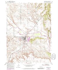
1950 Map of Edgemont
USGS Topo · Published 1986About this map
Edgemont serves as a critical junction along the Cheyenne River and the Burlington Northern railroad, illustrating the mid-century industrial and transport hub of Fall River County. The map details a landscape transitioning from the steep canyons of the Harney National Forest to the open river valley. Of particular interest is the Abandoned Canal and the presence of several Gravel Pits, pointing to early irrigation efforts and local extractive industries. Cultural landmarks of the era are well-represented, from the Drive-in Theater near Dudley to the Municipal Airport and Fairgrounds south of the main townsite. The proximity of the Edgemont Cem and outlying settlements like Dennis provides valuable geographic context for genealogists tracing family ties to this southwestern South Dakota community.
Find a feature on this map
32 named features on this map. Tap any name to fly to it.
Don’t see what you’re looking for? This feature index may not catch every label — zoom into the map to look around manually.
Map Details
Editions of this 1950 Edgemont Map
4 editions found
Other maps of this area

1902 · Edgemont
USGS Topo · 1:125,000

1950 · Edgemont
USGS Topo · 1:24,000

1950 · Edgemont SW
USGS Topo · 1:24,000

1950 · Rumford
USGS Topo · 1:24,000

1950 · Burdock
USGS Topo · 1:24,000

1950 · Edgemont NE
USGS Topo · 1:24,000

1950 · Minnekahta
USGS Topo · 1:24,000

1950 · Flint Hill
USGS Topo · 1:24,000

1955 · Hot Springs
USGS Topo · 1:250,000
1982 · Provo
USGS Topo · 1:25,000