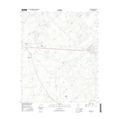
2016 Map of Edgewood
USGS Topo · Published 2016About this map
Wills Point and Edgewood anchor this portion of the East Texas blacklands, where the landscape is defined by a dense network of county roads and numerous small reservoirs. The region's history is preserved in its many family and community burial grounds, such as White Rose Cem and Oak Hill Cem. The terrain is drained by several creeks including Cedar Cr and Giladon Cr, which feed into local water bodies like T P Lake and Old City Lake.
Find a feature on this map
125 named features on this map. Tap any name to fly to it.
Don’t see what you’re looking for? This feature index may not catch every label — zoom into the map to look around manually.
Map Details
Editions of this 2016 Edgewood Map
This is the sole edition of this map. No revisions or reprints were ever made.
Other maps of this area

1954 · Dallas
USGS Topo · 1:250,000

1956 · Tyler
USGS Topo · 1:250,000

1956 · Quinlan
USGS Topo · 1:62,500

1956 · Emory
USGS Topo · 1:62,500

1958 · Dallas
USGS Topo · 1:250,000

1962 · Myrtle Springs
USGS Topo · 1:24,000

1962 · Cedarvale
USGS Topo · 1:24,000

1962 · Wills Point
USGS Topo · 1:24,000
1962 · Canton
USGS Topo · 1:24,000
1962 · Edgewood
USGS Topo · 1:24,000