
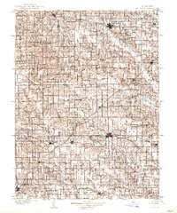
1903 Map of Edina
USGS Topo · Published 1903About this map
The Edina area of Northeast Missouri is defined by a dense network of early 20th-century railroads and the branching tributaries of the Fabius River. Three major rail lines intersect this agricultural landscape: the Quincy Omaha and Kansas City R. R. passing through the county seat, the Atchison Topeka and Santa Fe R. R. cutting diagonally through Baring, and the Keokuk and Western R. R. serving northern communities like Memphis. This rail infrastructure supported numerous small trade centers and post offices, many of which were tied to specific geographic features or early settlers, such as Locust Hill, Hedge City, and Bible Grove. The map also illustrates the intricate hydrology of the region, where the North Fabius River, Middle Fabius River, and South Fabius River carve through the townships of Jefferson, Benton, and Greensburg.
Find a feature on this map
83 named features on this map. Tap any name to fly to it.
Don’t see what you’re looking for? This feature index may not catch every label — zoom into the map to look around manually.
Map Details
Editions of this 1903 Edina Map
2 editions found
Other maps of this area

1903 · Kahoka
USGS Topo · 1:125,000

1903 · Palmyra
USGS Topo · 1:125,000

1908 · Atlanta
USGS Topo · 1:62,500

1911 · Queen City
USGS Topo · 1:62,500

1913 · Queen City
USGS Topo · 1:62,500

1937 · Elmer
USGS Topo · 1:48,000

1938 · Kirksville
USGS Topo · 1:62,500

1940 · Kirksville
USGS Topo · 1:62,500

1942 · Elmer
USGS Topo · 1:62,500

1948 · Quincy
USGS Topo · 1:250,000