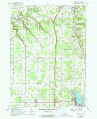
1967 Map of Edinboro North
USGS Topo · Published 1991About this map
Elk Creek and its various tributaries, including Goodban Run and Porter Run, carve a network of valleys through the township of Franklin. This rural landscape of Erie County in the late 1960s is characterized by small crossroads settlements and family-named infrastructure, such as Mishler Corners and Powers Corners. The northern portion of the map is anchored by the borough of Middleboro, while the southern end transitions toward the recreation-oriented waters of Edinboro Lake and the nearby Golf Course.
Find a feature on this map
63 named features on this map. Tap any name to fly to it.
Don’t see what you’re looking for? This feature index may not catch every label — zoom into the map to look around manually.
Map Details
Editions of this 1967 Edinboro North Map
3 editions found
Other maps of this area

1899 · Erie
USGS Topo · 1:62,500

1900 · Girard
USGS Topo · 1:62,500

1900 · Erie
USGS Topo · 1:62,500

1900 · Fairview
USGS Topo · 1:62,500

1923 · Cambridge Springs
USGS Topo · 1:62,500

1925 · Cambridge Springs
USGS Topo · 1:62,500

1943 · Cambridge Springs
USGS Topo · 1:62,500

1950 · Cleveland
USGS Topo · 1:250,000

1950 · Erie
USGS Topo · 1:250,000

1956 · Cleveland
USGS Topo · 1:250,000