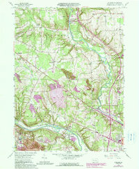
1958 Map of Edinburg
USGS Topo · Published 1990About this map
The Shenango River and Mahoning River valleys define the landscape of Lawrence County in this mid-century survey, updated with late-1980s data. The area's industrial legacy is clearly visible through numerous strip mines and a large Slag Pile, particularly near Hillsville and the western border. These extractive footprints contrast with public spaces like the State Game Land No 150 and Rolling Hills Golf Course.
Find a feature on this map
51 named features on this map. Tap any name to fly to it.
Don’t see what you’re looking for? This feature index may not catch every label — zoom into the map to look around manually.
Map Details
Editions of this 1958 Edinburg Map
4 editions found
Other maps of this area

1902 · New Castle
USGS Topo · 1:62,500

1904 · Newcastle
USGS Topo · 1:62,500

1905 · Neshannock
USGS Topo · 1:62,500

1906 · Youngstown
USGS Topo · 1:62,500

1907 · Neshannock
USGS Topo · 1:62,500

1907 · Columbiana
USGS Topo · 1:62,500

1908 · Youngstown
USGS Topo · 1:62,500

1909 · Columbiana
USGS Topo · 1:62,500

1950 · Cleveland
USGS Topo · 1:250,000

1951 · Canton
USGS Topo · 1:250,000
Featured Places
- Pulaski Township, PA
- Frizzleburg, Pulaski Township
- Neshannock Township, PA
- Edinburg, Mahoning Township
- North Edinburg, Mahoning Township