
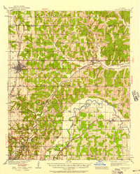
1935 Map of Edmond
USGS Topo · Published 1935About this map
The growing town of Edmond serves as the focal point of this 1935 survey, situated at the crossroads of the Atchison Topeka and Santa Fe railroad and local thoroughfares. The landscape transitions from the developed streets of the town into a rural network of school districts and early highways. Notable educational landmarks like Enterprise Sch and Mount Zion Sch are scattered throughout the northern townships, reflecting the community-centered layout of central Oklahoma during the mid-1930s.
Find a feature on this map
34 named features on this map. Tap any name to fly to it.
Don’t see what you’re looking for? This feature index may not catch every label — zoom into the map to look around manually.
Map Details
Editions of this 1935 Edmond Map
2 editions found
Other maps of this area

1892 · Moore
USGS Topo · 1:62,500

1892 · Guthrie
USGS Topo · 1:62,500

1892 · Edmond
USGS Topo · 1:62,500

1892 · Kingfisher
USGS Topo · 1:125,000

1893 · Oklahoma City
USGS Topo · 1:62,500

1895 · Kingfisher
USGS Topo · 1:125,000

1898 · Purcell
USGS Topo · 1:125,000

1904 · Chickasha
USGS Topo · 1:125,000

1909 · Luther
USGS Topo · 1:62,500

1909 · Perkins
USGS Topo · 1:62,500