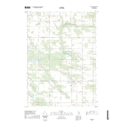
2023 Map of Edmore
USGS Topo · Published 2023About this map
Edmore serves as the primary hub of this west-central Michigan landscape, situated at the intersection of Howard City Edmore Rd and M 46. The settlement pattern follows a traditional grid, transitioning into the smaller northern hamlet of Wyman. Local history is anchored by the Vinewood Cem at the south edge of town and Home Cem to the northeast.
Find a feature on this map
83 named features on this map. Tap any name to fly to it.
Don’t see what you’re looking for? This feature index may not catch every label — zoom into the map to look around manually.
Map Details
Editions of this 2023 Edmore Map
This is the sole edition of this map. No revisions or reprints were ever made.
Other maps of this area

1916 · Mount Pleasant
USGS Topo · 1:62,500

1919 · Mount Pleasant
USGS Topo · 1:62,500

1943 · Mount Pleasant
USGS Topo · 1:62,500

1954 · Midland
USGS Topo · 1:250,000

1958 · Midland
USGS Topo · 1:250,000

1959 · Midland
USGS Topo · 1:250,000

1964 · Edmore
USGS Topo · 1:24,000

1964 · Six Lakes
USGS Topo · 1:24,000

1964 · Blanchard
USGS Topo · 1:24,000

1964 · Langston
USGS Topo · 1:24,000