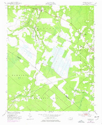
1950 Map of Edward
USGS Topo · Published 1977About this map
Blounts Creek and the surrounding coastal plain of Beaufort and Craven Counties are captured here as they appeared mid-century, defined by a landscape of vast swampy lowlands and small agricultural settlements. The Norfolk Southern railroad provides the primary industrial spine of the region, cutting southeast through Richland and connecting the village of Edward to the wider trade network. Numerous small congregations dot the rural intersections, including Warren Chapel and Smyrna Ch near the northern creeks, suggesting a deeply rooted community structure focused around local churches.
Find a feature on this map
32 named features on this map. Tap any name to fly to it.
Don’t see what you’re looking for? This feature index may not catch every label — zoom into the map to look around manually.
Map Details
Editions of this 1950 Edward Map
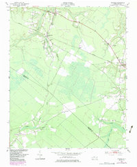
Other maps of this area

1901 · New Bern
USGS Topo · 1:62,500

1902 · Vanceboro
USGS Topo · 1:62,500

1903 · New Bern
USGS Topo · 1:62,500

1904 · Vanceboro
USGS Topo · 1:62,500

1905 · Vanceboro
USGS Topo · 1:62,500

1950 · Aurora
USGS Topo · 1:24,000

1950 · Edward
USGS Topo · 1:24,000

1951 · Bath
USGS Topo · 1:24,000

1951 · Hackney
USGS Topo · 1:24,000

1953 · Blounts Bay
USGS Topo · 1:24,000