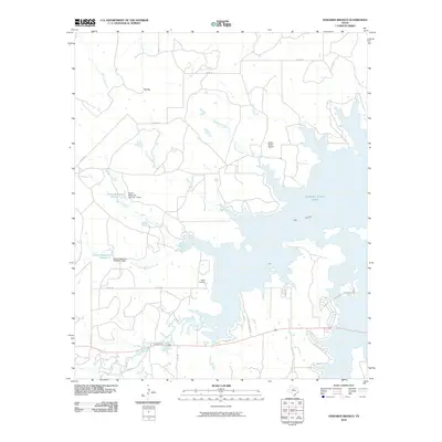
2010 Map of Edwards Branch
USGS Topo · Published 2010About this map
Hubbard Creek Lake dominates the central landscape of this Stephens County region, where the sprawling reservoir meets a network of seasonal watercourses and private ranching infrastructure. The topographic detail highlights the water management systems of the area, specifically Green Reservoir Number 1 and Green Reservoir Number 2, each supported by its respective dam. These man-made features sit alongside natural landmarks like Flat Top and The Island, reflecting a land defined by its hydrological modifications.
Find a feature on this map
31 named features on this map. Tap any name to fly to it.
Don’t see what you’re looking for? This feature index may not catch every label — zoom into the map to look around manually.
Map Details
Editions of this 2010 Edwards Branch Map
This is the sole edition of this map. No revisions or reprints were ever made.
Other maps of this area

1890 · Breckenridge
USGS Topo · 1:125,000

1892 · Albany
USGS Topo · 1:125,000

1893 · Albany
USGS Topo · 1:125,000

1954 · Abilene
USGS Topo · 1:250,000

1958 · Abilene
USGS Topo · 1:250,000

1958 · Breckenridge
USGS Topo · 1:24,000

1958 · Edwards Branch
USGS Topo · 1:24,000

1961 · Buck Mountain
USGS Topo · 1:24,000

1961 · Eolian
USGS Topo · 1:24,000

1965 · McCatherine Mountain
USGS Topo · 1:24,000