
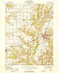
1951 Map of Effingham
USGS Topo · Published 1951About this map
The intersection of the Illinois Central, Pennsylvania, and Baltimore and Ohio railroads defines the mid-century industrial landscape of Effingham. This post-war survey illustrates a region where rail commerce and agriculture intertwined, anchored by the county seat and the western hub of Altamont. Rural life is meticulously documented through a network of country schools and churches, including White Chapel, Ebenezer Ch, and the St Johns Ch.
Find a feature on this map
96 named features on this map. Tap any name to fly to it.
Don’t see what you’re looking for? This feature index may not catch every label — zoom into the map to look around manually.
Map Details
Editions of this 1951 Effingham Map
2 editions found
Other maps of this area

1934 · Mattoon
USGS Topo · 1:62,500

1937 · Mattoon
USGS Topo · 1:62,500

1941 · St. Elmo
USGS Topo · 1:62,500

1942 · Shelbyville
USGS Topo · 1:62,500

1945 · St. Elmo
USGS Topo · 1:62,500

1945 · Kinmundy
USGS Topo · 1:62,500

1946 · Shelbyville
USGS Topo · 1:62,500

1947 · Kinmundy
USGS Topo · 1:62,500

1947 · Stewardson
USGS Topo · 1:62,500

1949 · Stewardson
USGS Topo · 1:62,500