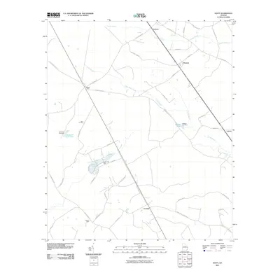
2011 Map of Egypt
USGS Topo · Published 2011About this map
Egypt and Ardmore anchor this section of the coastal plain, where early 21st-century Georgia remains shaped by rural settlement patterns and a network of minor waterways. The landscape is defined by the drainage of Cowpen Branch and Turkey Branch, punctuated by private water management features like Grafarwill Trust Pond and Griffin Lake. The transport network reveals layers of regional history, with thoroughfares such as Old Dixie Hwy S, Savannah Town RD, and Old Elam Cemetery RD connecting small hubs like Shawnee and Tusculum. The presence of the Elam Cemetery and family-named infrastructure such as the Allison Dam provides specific points of interest for genealogists and local historians tracing the development of Effingham County. These features suggest an economy and community still closely tied to the land and historical transit routes leading toward the Savannah area.
Find a feature on this map
42 named features on this map. Tap any name to fly to it.
Don’t see what you’re looking for? This feature index may not catch every label — zoom into the map to look around manually.
Map Details
Editions of this 2011 Egypt Map
This is the sole edition of this map. No revisions or reprints were ever made.
Other maps of this area

1918 · Oliver
USGS Topo · 1:62,500

1919 · Shirley
USGS Topo · 1:62,500

1919 · Egypt
USGS Topo · 1:62,500

1920 · Oliver
USGS Topo · 1:62,500

1921 · Brooklet
USGS Topo · 1:62,500

1939 · Egypt
USGS Topo · 1:62,500

1943 · Brooklet
USGS Topo · 1:62,500

1943 · Egypt
USGS Topo · 1:62,500

1943 · Shirley
USGS Topo · 1:62,500

1943 · Millen
USGS Topo · 1:125,000