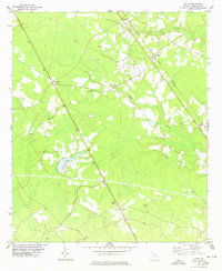
1978 Map of Egypt
USGS Topo · Published 1978About this map
The Central of Georgia railroad corridor serves as the primary spine of settlement through this section of Effingham County, connecting the small communities of Egypt, Shawnee, and Ardmore. The landscape is a mosaic of cultivated land and low-lying drainage basins, such as Big Bay and Cowpen Branch, which dictate the placement of roads and farmsteads. Local history is anchored by a significant concentration of rural assembly points, including Thomas Chapel and Corinth Ch, reflecting a deeply rooted community structure in the late 1970s.
Find a feature on this map
23 named features on this map. Tap any name to fly to it.
Don’t see what you’re looking for? This feature index may not catch every label — zoom into the map to look around manually.
Map Details
Editions of this 1978 Egypt Map
This is the sole edition of this map. No revisions or reprints were ever made.
Other maps of this area

1918 · Oliver
USGS Topo · 1:62,500

1919 · Shirley
USGS Topo · 1:62,500

1919 · Egypt
USGS Topo · 1:62,500

1920 · Oliver
USGS Topo · 1:62,500

1921 · Brooklet
USGS Topo · 1:62,500

1939 · Egypt
USGS Topo · 1:62,500

1943 · Brooklet
USGS Topo · 1:62,500

1943 · Egypt
USGS Topo · 1:62,500

1943 · Shirley
USGS Topo · 1:62,500

1943 · Millen
USGS Topo · 1:125,000