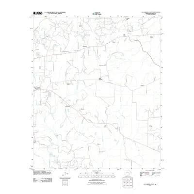
2011 Map of El Dorado East
USGS Topo · Published 2011About this map
Ezell Oil Field and the East El Dorado Oil Field define the industrial character of this Union County landscape, where energy extraction meets a dense network of rural settlements. Small communities like Smithville, Perdue City, and Old Union are scattered among the timber and creeks, connected by roads such as Champagnolle Rd and Industrial Rd. The terrain is deeply marked by local history, evidenced by numerous burial sites including Zion Watch Cemetery, Beulah Springs Cemetery, and the Free Union Cemetery. Waterways like Bogay Creek and Cany Creek thread through the production zones, while the Nick Springs Lookout Tower stands as a prominent landmark near the Nick Springs Oil Field. This survey captures the complex intersection of Arkansas petroleum history and established family lands just east of the regional hub.
Find a feature on this map
101 named features on this map. Tap any name to fly to it.
Don’t see what you’re looking for? This feature index may not catch every label — zoom into the map to look around manually.
Map Details
Editions of this 2011 El Dorado East Map
This is the sole edition of this map. No revisions or reprints were ever made.
Other maps of this area

1927 · El Dorado
USGS Topo · 1:62,500

1930 · El Dorado
USGS Topo · 1:62,500

1933 · Strong
USGS Topo · 1:62,500

1934 · Moro Bay
USGS Topo · 1:62,500

1937 · Strong
USGS Topo · 1:62,500

1938 · Moro Bay
USGS Topo · 1:62,500

1939 · Moro Bay
USGS Topo · 1:62,500

1939 · Strong
USGS Topo · 1:62,500

1951 · El Dorado
USGS Topo · 1:62,500

1953 · El Dorado
USGS Topo · 1:250,000