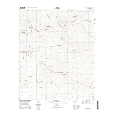
2014 Map of El Dorado East
USGS Topo · Published 2014About this map
El Dorado and its eastern environs are defined by the pervasive oil industry that transformed this part of Union County. Multiple production zones including the East El Dorado Oil Field, Champagnolle Oil Field, and Nick Springs Oil Field mark the landscape with a dense network of specialized roads like Spires Ln and Old Cedar Tree Rd. The map reveals a high concentration of community burial sites, from the centrally located Wesley Cem to the outlying Beulah Springs Cem, suggesting a well-established rural social structure alongside the industrial extraction. Small clusters of settlement persist at Smithville and Old Union, while the Nick Springs Lookout Tower stands as a prominent landmark overlooking the creek basins of Salt Cr and Cany Cr.
Find a feature on this map
106 named features on this map. Tap any name to fly to it.
Don’t see what you’re looking for? This feature index may not catch every label — zoom into the map to look around manually.
Map Details
Editions of this 2014 El Dorado East Map
This is the sole edition of this map. No revisions or reprints were ever made.
Other maps of this area

1927 · El Dorado
USGS Topo · 1:62,500

1930 · El Dorado
USGS Topo · 1:62,500

1933 · Strong
USGS Topo · 1:62,500

1934 · Moro Bay
USGS Topo · 1:62,500

1937 · Strong
USGS Topo · 1:62,500

1938 · Moro Bay
USGS Topo · 1:62,500

1939 · Moro Bay
USGS Topo · 1:62,500

1939 · Strong
USGS Topo · 1:62,500

1951 · El Dorado
USGS Topo · 1:62,500

1953 · El Dorado
USGS Topo · 1:250,000