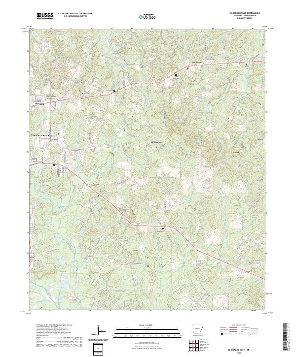
2024 Map of El Dorado East
USGS Topo · Published 2024About this map
The eastern outskirts of El Dorado transition into a landscape of dense drainage networks and rural community centers in this modern survey of Union County. The eastern reach of the city is anchored by the South Arkansas Community College East Campus, while the surrounding countryside is defined by the winding paths of Boggy Creek and the Bayou de Loutre. This map is particularly valuable for genealogists, as it documents numerous legacy burial grounds including Old Union Cem, Saint Paul Cem, and Shady Grove Cem, often located near crossroads like Old Union and Nick Springs.
Find a feature on this map
98 named features on this map. Tap any name to fly to it.
Don’t see what you’re looking for? This feature index may not catch every label — zoom into the map to look around manually.
Map Details
Editions of this 2024 El Dorado East Map
This is the sole edition of this map. No revisions or reprints were ever made.
Other maps of this area

1927 · El Dorado
USGS Topo · 1:62,500

1930 · El Dorado
USGS Topo · 1:62,500

1933 · Strong
USGS Topo · 1:62,500

1934 · Moro Bay
USGS Topo · 1:62,500

1937 · Strong
USGS Topo · 1:62,500

1938 · Moro Bay
USGS Topo · 1:62,500

1939 · Moro Bay
USGS Topo · 1:62,500

1939 · Strong
USGS Topo · 1:62,500

1951 · El Dorado
USGS Topo · 1:62,500

1953 · El Dorado
USGS Topo · 1:250,000