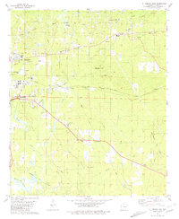
1981 Map of El Dorado East
USGS Topo · Published 1981About this map
The East El Dorado Oil Field and surrounding petroleum landscape dominate this eastern portion of Union County during the early 1980s. The map reveals an intensive industrial network of oil wells, pipelines, and a refinery operating alongside established rural communities. Cultural centers such as Old Union and Perdue City are depicted alongside numerous country churches, including St Pauls Ch and Union Ch. Educational infrastructure is represented by the Oil Belt Voc-Tech Sch and Union High Sch, reflecting the region's mid-century growth.
Find a feature on this map
44 named features on this map. Tap any name to fly to it.
Don’t see what you’re looking for? This feature index may not catch every label — zoom into the map to look around manually.
Map Details
Editions of this 1981 El Dorado East Map
This is the sole edition of this map. No revisions or reprints were ever made.
Other maps of this area

1927 · El Dorado
USGS Topo · 1:62,500

1930 · El Dorado
USGS Topo · 1:62,500

1933 · Strong
USGS Topo · 1:62,500

1934 · Moro Bay
USGS Topo · 1:62,500

1937 · Strong
USGS Topo · 1:62,500

1938 · Moro Bay
USGS Topo · 1:62,500

1939 · Moro Bay
USGS Topo · 1:62,500

1939 · Strong
USGS Topo · 1:62,500

1951 · El Dorado
USGS Topo · 1:62,500

1953 · El Dorado
USGS Topo · 1:250,000