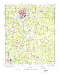
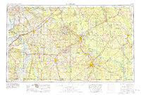
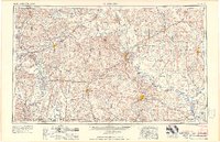
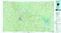
1985 Map of El Dorado
USGS Topo · Published 1986About this map
The Oil and Gas Field and Smackover Gas Field dominate this mid-1980s landscape, reflecting the heavy industrial character of south-central Arkansas. Centered on El Dorado, the map traces a complex network of energy infrastructure and transportation, including the Missouri Pacific and Chicago Rock Island & Pacific railroads. The industrial footprint is balanced by the expansive Felsenthal National Wildlife Refuge to the southeast, where the Ouachita River and Saline River converge into a vast wetland system featuring the Felsenthal Pool and Grand Marais Lake.
Find a feature on this map
91 named features on this map. Tap any name to fly to it.
Don’t see what you’re looking for? This feature index may not catch every label — zoom into the map to look around manually.
Map Details
Editions of this 1985 El Dorado Map
2 editions found
Historical Maps of El Dorado Through Time
9 maps found