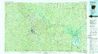
1985 Map of El Dorado
USGS Topo · Published 1988About this map
El Dorado serves as the industrial and logistical hub of this South Arkansas landscape, where the local economy is deeply tied to the extensive Oil And Gas Field operations visible across the region. The map documents a complex network of transportation, including the St Louis Southwestern and Missouri Pacific railroads that historically connected timber and petroleum interests to wider markets. To the east, the sprawling wetlands of the Felsenthal National Wildlife Refuge dominate the basin where the Ouachita River meets the Saline River. This area is characterized by an intricate system of backwaters like Eagle Lake and Grand Marais Lake, and historic river points such as Wilmington Landing. Smaller settlements like Smackover, Norphlet, and Huttig are mapped alongside rural landmarks, including the Pleasant Grove Ch and various unnamed cemeteries, providing a clear record of 1980s habitation patterns in Union County.
Find a feature on this map
145 named features on this map. Tap any name to fly to it.
Don’t see what you’re looking for? This feature index may not catch every label — zoom into the map to look around manually.
Map Details
Editions of this 1985 El Dorado Map
2 editions found
Other maps of this area

1901 · Gurdon
USGS Topo · 1:125,000

1903 · Camden
USGS Topo · 1:125,000

1927 · El Dorado
USGS Topo · 1:62,500

1930 · El Dorado
USGS Topo · 1:62,500

1933 · Strong
USGS Topo · 1:62,500

1934 · Ingalls
USGS Topo · 1:48,000

1934 · Felsenthal
USGS Topo · 1:62,500

1934 · Moro Bay
USGS Topo · 1:62,500

1935 · Naff
USGS Topo · 1:62,500

1935 · Haile
USGS Topo · 1:62,500