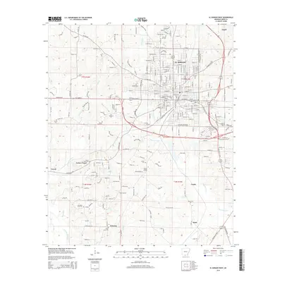
2014 Map of El Dorado West
USGS Topo · Published 2014About this map
The western outskirts of El Dorado and the surrounding Union County countryside are defined by the intersection of industrial energy production and long-standing community landmarks. The South El Dorado Oil Field and the Nick Springs Oil Field signify the region's historical and economic ties to the petroleum industry. These fields sit alongside established settlements like Parkers Chapel and Pickering, where numerous family and community burial grounds, such as Old Parkers Chapel Cem and Shady Grove Cem, offer rich data for genealogical research.
Find a feature on this map
183 named features on this map. Tap any name to fly to it.
Don’t see what you’re looking for? This feature index may not catch every label — zoom into the map to look around manually.
Map Details
Editions of this 2014 El Dorado West Map
This is the sole edition of this map. No revisions or reprints were ever made.
Other maps of this area

1927 · El Dorado
USGS Topo · 1:62,500

1930 · El Dorado
USGS Topo · 1:62,500

1951 · El Dorado
USGS Topo · 1:62,500

1953 · El Dorado
USGS Topo · 1:250,000

1957 · El Dorado
USGS Topo · 1:250,000

1958 · El Dorado
USGS Topo · 1:250,000

1960 · El Dorado
USGS Topo · 1:250,000

1962 · Lisbon
USGS Topo · 1:24,000

1962 · Smackover
USGS Topo · 1:24,000
1962 · Calion
USGS Topo · 1:24,000