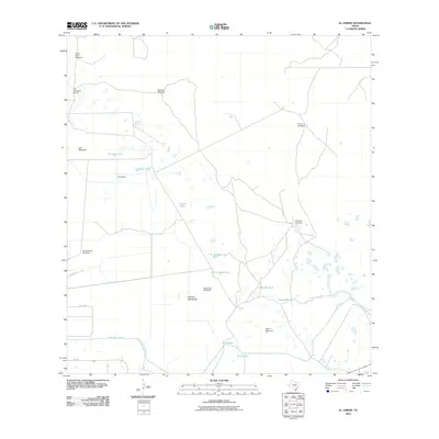
2010 Map of El Jardin
USGS Topo · Published 2010About this map
San Francisco Ranch and the small settlement at El Jardin anchor this South Texas landscape during a period of sustained agricultural and ranching activity. The terrain is characterized by an extensive network of water management features, including several large catchments such as El Jardin Tank, Catanes Tank, and Coyotes Tank. This infrastructure reflects the vital necessity of water storage in this semi-arid region, where human activity is closely tied to these central hubs.
Find a feature on this map
32 named features on this map. Tap any name to fly to it.
Don’t see what you’re looking for? This feature index may not catch every label — zoom into the map to look around manually.
Map Details
Editions of this 2010 El Jardin Map
This is the sole edition of this map. No revisions or reprints were ever made.
Other maps of this area

1921 · Tarida Ranch
USGS Topo · 1:62,500

1952 · South of Potrero Lopeno NW
USGS Topo · 1:24,000

1952 · Hawk Island
USGS Topo · 1:24,000

1952 · Port Mansfield
USGS Topo · 1:24,000

1952 · South of Potrero Lopeno
USGS Topo · 1:62,500

1953 · Brownsville
USGS Topo · 1:250,000
1955 · La Leona
USGS Topo · 1:62,500

1956 · San Perlita South
USGS Topo · 1:24,000

1956 · Rosita Lake
USGS Topo · 1:24,000

1956 · San Perlita North
USGS Topo · 1:24,000