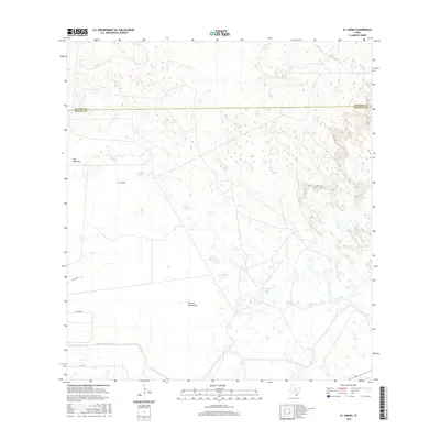
2016 Map of El Jardin
USGS Topo · Published 2016About this map
El Jardin and the neighboring settlements of Plan de Monterrey and Los Becerros anchor this coastal Texas landscape along the border of Willacy and Kenedy Counties. The terrain is characterized by a high density of watering locations, often named with a personal or descriptive touch, such as Flor de Mayo Tank, Don Delfino Tank, and Coyotes Tank. These water sources are essential features in a region where the natural hydrology is supplemented by infrastructure like the East Main Drain. The road network, including FM 3142, provides the primary connections between these dispersed settlements and the surrounding rangeland. This survey captures a specific moment in the rural development of the South Texas plains, showing how land use and water management have shaped the local community structure and names.
Find a feature on this map
17 named features on this map. Tap any name to fly to it.
Don’t see what you’re looking for? This feature index may not catch every label — zoom into the map to look around manually.
Map Details
Editions of this 2016 El Jardin Map
This is the sole edition of this map. No revisions or reprints were ever made.
Other maps of this area

1921 · Tarida Ranch
USGS Topo · 1:62,500

1952 · South of Potrero Lopeno NW
USGS Topo · 1:24,000

1952 · Hawk Island
USGS Topo · 1:24,000

1952 · Port Mansfield
USGS Topo · 1:24,000

1952 · South of Potrero Lopeno
USGS Topo · 1:62,500

1953 · Brownsville
USGS Topo · 1:250,000
1955 · La Leona
USGS Topo · 1:62,500

1956 · San Perlita South
USGS Topo · 1:24,000

1956 · Rosita Lake
USGS Topo · 1:24,000

1956 · San Perlita North
USGS Topo · 1:24,000