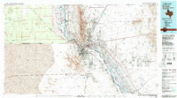
1983 Map of El Paso
USGS Topo · Published 1983About this map
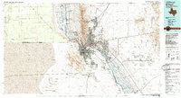
The Rio Grande serves as the focal point for this international border region, bisecting the urban sprawl of El Paso and Ciudad Juarez. In the early 1980s, the landscape was defined by the sharp transition from the residential and commercial centers to the surrounding desert and mountain ranges. The Franklin Mountains rise abruptly from the city center, while the eastern portion of the sheet is dominated by the sprawling Fort Bliss Military Reservation and industrial infrastructure like Biggs Army Airfield and the Aeropuerto Internacional.
Find a feature on this map
74 named features on this map. Tap any name to fly to it.
Don’t see what you’re looking for? This feature index may not catch every label — zoom into the map to look around manually.
Map Details
Editions of this 1983 El Paso Map
2 editions found
Other maps of this area

1891 · Las Cruces
USGS Topo · 1:125,000

1893 · Las Cruces
USGS Topo · 1:125,000

1894 · Fort Hancock
USGS Topo · 1:125,000

1896 · El Paso
USGS Topo · 1:125,000

1896 · Rio Grande
USGS Topo · 1:125,000

1903 · Cerro Alto
USGS Topo · 1:125,000

1908 · El Paso
USGS Topo · 1:125,000

1917 · Canutillo
USGS Topo · 1:62,500

1917 · Noria
USGS Topo · 1:62,500

1917 · Mt. Riley
USGS Topo · 1:62,500