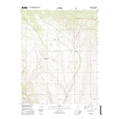
2017 Map of El Rito
USGS Topo · Published 2017About this map
El Rito and the nearby settlement of Las Placitas serve as the primary human centers in this high-desert landscape of northern New Mexico. The area is deeply marked by the intricate network of canyons and arroyos that feed into the central El Rito waterway, including Stone Canyon to the north and Alamosa Canyon to the south. Large portions of the territory fall within the Carson National Forest, where the topography rises sharply toward features like Sierra Negra and the expansive Pinon Mesa.
Find a feature on this map
41 named features on this map. Tap any name to fly to it.
Don’t see what you’re looking for? This feature index may not catch every label — zoom into the map to look around manually.
Map Details
Editions of this 2017 El Rito Map
This is the sole edition of this map. No revisions or reprints were ever made.
Other maps of this area

1918 · Abiquiu
USGS Topo · 1:125,000

1953 · Abiquiu
USGS Topo · 1:24,000

1953 · Medanales
USGS Topo · 1:24,000

1953 · Valle Grande Peak
USGS Topo · 1:24,000

1953 · Lyden
USGS Topo · 1:24,000

1953 · Magote Peak
USGS Topo · 1:24,000

1953 · El Rito
USGS Topo · 1:24,000

1953 · La Madera
USGS Topo · 1:24,000

1953 · Ojo Caliente
USGS Topo · 1:24,000

1953 · Canjilon SE
USGS Topo · 1:24,000