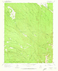
1964 Map of El Valle
USGS Topo · Published 1973About this map
El Valle and Vallecitos occupy the lower elevations of this high-altitude landscape, where complex irrigation systems like the Acequia de Abajo de El Valle and Acequia Madre de Llano San Juan sustain agriculture along the river valleys. The 1964 field survey reveals a terrain defined by Spanish land grants and timbered tracts, including the Las Trampas Grant and the Diamante Tract. The southeastern portion of the map climbs into the Pecos Wilderness, featuring high-country landmarks such as Trampas Peak and San Leonardo Lakes. A network of jeep and pack trails connects remote points like Osha Cienaga to the small settlements, documenting a period when traditional acequia water management remained central to the local economy within the Carson National Forest.
Find a feature on this map
50 named features on this map. Tap any name to fly to it.
Don’t see what you’re looking for? This feature index may not catch every label — zoom into the map to look around manually.
Map Details
Editions of this 1964 El Valle Map
3 editions found
Other maps of this area

1889 · Santa Fe
USGS Topo · 1:125,000

1894 · Santa Fe
USGS Topo · 1:125,000

1953 · Truchas
USGS Topo · 1:24,000

1953 · Sierra Mosca
USGS Topo · 1:24,000

1953 · Trampas
USGS Topo · 1:24,000

1954 · Santa Fe
USGS Topo · 1:250,000

1954 · Raton
USGS Topo · 1:250,000

1958 · Raton
USGS Topo · 1:250,000

1958 · Santa Fe
USGS Topo · 1:250,000
1963 · Truchas Peak
USGS Topo · 1:24,000