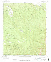
1964 Map of El Valle
USGS Topo · Published 1973About this map
El Valle and the surrounding high-altitude terrain define this 1964 survey of the Sangre de Cristo foothills, where centuries of communal land management are visible through extensive Spanish land grants. Large tracts like the Las Trampas Grant, Francisco Montes Vigil Grant, and the expansive Nuestra Senora del Rosario San Fernando y Santiago Grant dominate the landscape. The water systems are equally significant, featuring traditional irrigation channels such as the Acequia de Abajo de El Valle and Acequia Madre de Llano San Juan which draw from the Rio de las Trampas. This network of acequias illustrates the historic agricultural practices required to sustain the settlements of Vallecitos and Hodges within the Carson National Forest. To the south, the terrain rises into the Pecos Wilderness, marked by high summits like Trampas Peak and Jicarilla Peak.
Find a feature on this map
46 named features on this map. Tap any name to fly to it.
Don’t see what you’re looking for? This feature index may not catch every label — zoom into the map to look around manually.
Map Details
Editions of this 1964 El Valle Map
3 editions found
Other maps of this area

1889 · Santa Fe
USGS Topo · 1:125,000

1894 · Santa Fe
USGS Topo · 1:125,000

1953 · Truchas
USGS Topo · 1:24,000

1953 · Sierra Mosca
USGS Topo · 1:24,000

1953 · Trampas
USGS Topo · 1:24,000

1954 · Santa Fe
USGS Topo · 1:250,000

1954 · Raton
USGS Topo · 1:250,000

1958 · Raton
USGS Topo · 1:250,000

1958 · Santa Fe
USGS Topo · 1:250,000
1963 · Truchas Peak
USGS Topo · 1:24,000