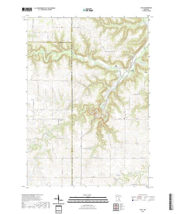
2022 Map of Elba
USGS Topo · Published 2022About this map
The settlement of Elba sits at the convergence of rugged blufflands and river valleys, where the N Fork Whitewater River meets the larger drainage system of southeastern Minnesota. The landscape is defined by its dramatic relief, featuring prominent elevations like Whiskey Hill and Calico Hill. Local history is anchored by several burial grounds, including Saint Aloysius Cem, Fairwater Cem, and Berea Cem, which serve as quiet markers of the area's rural development. Outdoor recreation and conservation are evident through an extensive network of managed paths such as the Whitewater River Trl, Dakota Trl, and Coyote Point Trl. Aviation history is noted by the presence of Van-Norman's Airport tucked between the winding forks of the river, while the complex local hydrology is further detailed by the Middle Fork Whitewater River and S Fork Whitewater River.
Find a feature on this map
76 named features on this map. Tap any name to fly to it.
Don’t see what you’re looking for? This feature index may not catch every label — zoom into the map to look around manually.
Map Details
Editions of this 2022 Elba Map
This is the sole edition of this map. No revisions or reprints were ever made.
Other maps of this area

1932 · Cochrane
USGS Topo · 1:62,500

1934 · Plainview
USGS Topo · 1:62,500

1934 · Cochrane
USGS Topo · 1:62,500

1937 · Cochrane
USGS Topo · 1:62,500

1938 · Plainview
USGS Topo · 1:62,500

1953 · Saint Paul
USGS Topo · 1:250,000

1953 · Eau Claire
USGS Topo · 1:250,000

1954 · Chatfield
USGS Topo · 1:62,500

1954 · Lewiston
USGS Topo · 1:62,500

1954 · Mason City
USGS Topo · 1:250,000