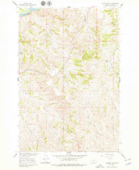
1960 Map of Eldering Ranch
USGS Topo · Published 1979About this map
The Yellowstone River flows along the northern edge of this Treasure County landscape, defining the local topography as it was documented in 1960. The Northern Pacific railroad tracks parallel the riverbank, providing a critical transportation link through this ranching territory. Away from the water, the terrain is characterized by a complex network of drainages and coulees, including Buckingham Coulee and Jacobs Coulee, which cut through the high ground. Central to the map is the eponymous Eldering Ranch, a primary site of settlement in this part of the Missouri River Basin. The presence of numerous springs, such as the one near Jacobs Coulee, and named watercourses like Forty-four Creek and Alkali Creek, indicates the vital importance of water resources to the local economy and land use during this era.
Find a feature on this map
16 named features on this map. Tap any name to fly to it.
Don’t see what you’re looking for? This feature index may not catch every label — zoom into the map to look around manually.
Map Details
Editions of this 1960 Eldering Ranch Map
3 editions found
Other maps of this area

1954 · Forsyth
USGS Topo · 1:250,000

1957 · Forsyth
USGS Topo · 1:250,000

1958 · Forsyth
USGS Topo · 1:250,000

1960 · Bighorn
USGS Topo · 1:24,000

1960 · Hysham
USGS Topo · 1:24,000

1960 · Myers
USGS Topo · 1:24,000

1960 · Rancher Cemetery
USGS Topo · 1:24,000

1960 · Marsh Coulee
USGS Topo · 1:24,000

1960 · Eldering Ranch
USGS Topo · 1:24,000

1960 · Hope Ranch
USGS Topo · 1:24,000