
1902 Map of Elders Ridge
USGS Topo · Published 1957About this map
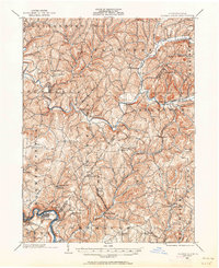
The Kiskiminetas River meanders through the southwestern corner of this 1902 landscape, serving as a vital industrial artery near Avonmore and Salina. The terrain is defined by a dense network of steep ridges and narrow valleys, where the Crooked Creek and Plum Creek systems drain the central and northern reaches. Settlement patterns at the turn of the century follow these waterways, with villages like South Bend and Elderton appearing as established hubs amid the agricultural and early industrial activity of Armstrong and Indiana Line counties.
Find a feature on this map
84 named features on this map. Tap any name to fly to it.
Don’t see what you’re looking for? This feature index may not catch every label — zoom into the map to look around manually.
Map Details
Editions of this 1902 Elders Ridge Map
2 editions found
Other maps of this area

1900 · Latrobe
USGS Topo · 1:62,500

1900 · Kittanning
USGS Topo · 1:62,500

1901 · Rural Valley
USGS Topo · 1:62,500

1902 · Kittanning
USGS Topo · 1:62,500

1902 · Latrobe
USGS Topo · 1:62,500

1902 · Indiana
USGS Topo · 1:62,500

1903 · Rural Valley
USGS Topo · 1:62,500

1903 · Latrobe
USGS Topo · 1:62,500

1904 · Elders Ridge
USGS Topo · 1:62,500

1904 · Greensburg
USGS Topo · 1:62,500