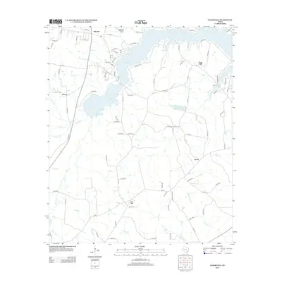
2013 Map of Elderville
USGS Topo · Published 2013About this map
Lake Cherokee dominates the northern reaches of this landscape, its irregular shoreline creating a complex network of residential roads such as Loblolly and Quail Run. This East Texas terrain is characterized by a dense system of small watercourses, including Tiawichi Creek, Bacon Creek, and Tenny Lewis Branch, which weave between small community hubs like Stewart, Chalk Hill, and Oak Hill.
Find a feature on this map
97 named features on this map. Tap any name to fly to it.
Don’t see what you’re looking for? This feature index may not catch every label — zoom into the map to look around manually.
Map Details
Editions of this 2013 Elderville Map
This is the sole edition of this map. No revisions or reprints were ever made.
Other maps of this area

1935 · Henderson
USGS Topo · 1:48,000

1936 · Kilgore
USGS Topo · 1:48,000

1939 · Henderson
USGS Topo · 1:62,500

1940 · Kilgore
USGS Topo · 1:62,500

1956 · Tyler
USGS Topo · 1:250,000

1958 · Tatum
USGS Topo · 1:62,500

1960 · Minden
USGS Topo · 1:62,500

1971 · Kilgore NE
USGS Topo · 1:24,000
1971 · Kilgore SE
USGS Topo · 1:24,000

1973 · Henderson
USGS Topo · 1:24,000