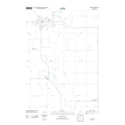
2013 Map of Eldora
USGS Topo · Published 2013About this map
The Iowa River meanders southward through the heart of Hardin County, anchoring a landscape defined by small river-town settlements and agricultural tradition. The city of Eldora serves as the primary hub, where the Hardin County Fairgrounds and the Greenbelt Speedway highlight the community's local heritage and entertainment roots. To the north, Upper Pine Lake marks a transition into more recreational terrain, while the broader county grid is punctuated by the smaller hamlets of Xenia, Gifford, and Whitten.
Find a feature on this map
85 named features on this map. Tap any name to fly to it.
Don’t see what you’re looking for? This feature index may not catch every label — zoom into the map to look around manually.
Map Details
Editions of this 2013 Eldora Map
This is the sole edition of this map. No revisions or reprints were ever made.
Other maps of this area

1954 · Waterloo
USGS Topo · 1:250,000

1955 · Waterloo
USGS Topo · 1:250,000

1960 · Marshalltown
USGS Topo · 1:62,500

1960 · Conrad West
USGS Topo · 1:24,000

1975 · State Center NW
USGS Topo · 1:24,000

1975 · Union
USGS Topo · 1:24,000

1979 · Steamboat Rock
USGS Topo · 1:24,000

1979 · New Providence
USGS Topo · 1:24,000

1979 · Eldora
USGS Topo · 1:24,000
1979 · Owasa
USGS Topo · 1:24,000