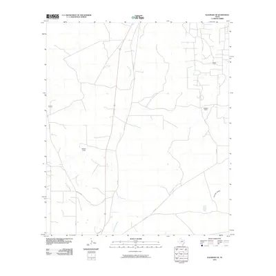
2010 Map of Eldorado NE
USGS Topo · Published 2010About this map
The South Concho River winds through this Schleicher County landscape, defining the local hydrology alongside intermittent drainage features like Whitten Draw and Milligan Draw. This area of the Edwards Plateau shows a distinct land use pattern where ranching infrastructure meets energy extraction, notably at the Hulldale Oil Field in the northeast. The distribution of resources is marked by the Vermont Windmill, a critical landmark in this semi-arid environment. Transportation follows a sparse grid of rural routes including Ruud Rd and Co Rd 302, providing access to the expansive properties that characterize this portion of West Texas. The presence of Live Oak Hollow suggests localized variations in vegetation and terrain that influenced the early positioning of homesteads and water access points.
Find a feature on this map
11 named features on this map. Tap any name to fly to it.
Don’t see what you’re looking for? This feature index may not catch every label — zoom into the map to look around manually.
Map Details
Editions of this 2010 Eldorado NE Map
This is the sole edition of this map. No revisions or reprints were ever made.
Other maps of this area

1892 · San Angelo
USGS Topo · 1:125,000

1893 · Fort McKavett
USGS Topo · 1:125,000

1895 · Sherwood
USGS Topo · 1:125,000

1954 · Sonora
USGS Topo · 1:250,000

1954 · San Angelo
USGS Topo · 1:250,000

1958 · Sonora
USGS Topo · 1:250,000

1958 · San Angelo
USGS Topo · 1:250,000

1963 · Adams NW
USGS Topo · 1:24,000

1963 · Adams SW
USGS Topo · 1:24,000

1964 · Eldorado NW
USGS Topo · 1:24,000