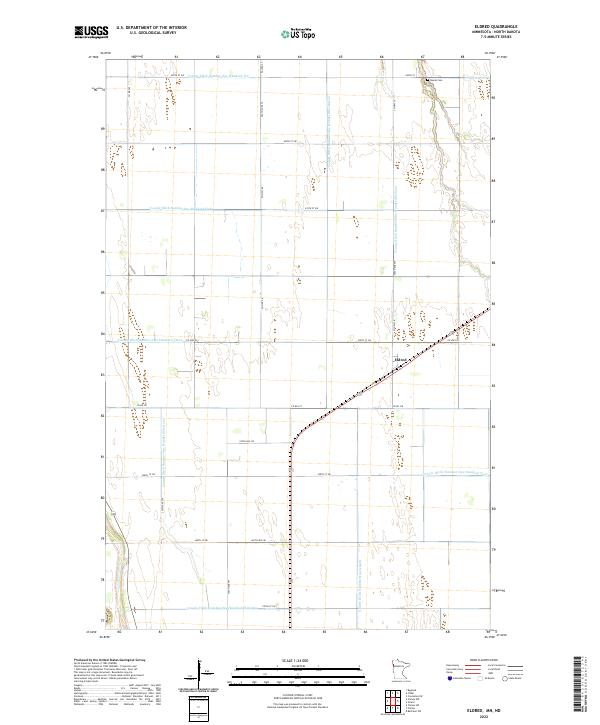
2022 Map of Eldred
USGS Topo · Published 2022About this map
Eldred serves as the primary settlement hub in this part of Polk County, where the transition from prairie to managed agricultural land is clearly marked by a extensive system of hydrological engineering. The landscape is defined by a dense grid of artificial waterways, including County Ditch Number One Hundred Sixteen and County Ditch Number One Hundred Seventeen, which represent a significant transformation of the Red River Valley drainage. These numbered ditches follow the section lines of the Public Land Survey System, illustrating how water management was integrated into the regional township and range layout. Local history and genealogy are anchored by the presence of Bardo Cem in the northeastern corner. The map also traces the routes of key transit corridors such as Co HWY 45 and Co HWY 56, which intersect the rural landscape to connect the scattered farmsteads of the surrounding townships.
Find a feature on this map
32 named features on this map. Tap any name to fly to it.
Don’t see what you’re looking for? This feature index may not catch every label — zoom into the map to look around manually.
Map Details
Editions of this 2022 Eldred Map
This is the sole edition of this map. No revisions or reprints were ever made.
Other maps of this area

1919 · Eldred
USGS Topo · 1:62,500

1919 · Beltrami
USGS Topo · 1:62,500

1952 · Grand Forks
USGS Topo · 1:250,000

1953 · Crookston
USGS Topo · 1:62,500

1956 · Grand Forks
USGS Topo · 1:250,000

1964 · Beltrami SW
USGS Topo · 1:24,000

1964 · Girard
USGS Topo · 1:24,000

1964 · Climax NW
USGS Topo · 1:24,000

1964 · Climax SW
USGS Topo · 1:24,000
1964 · Climax
USGS Topo · 1:24,000