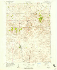
1953 Map of Eldridge
USGS Topo · Published 1957About this map
The town of Eldridge and the village of Long Grove anchor this 1953 survey of Scott County, Iowa. This rural landscape is defined by its townships—Winfield, Butler, Sheridan, and Lincoln—and a dense network of country schoolhouses. Many of these, such as School No 2 and School No 8, were already marked as abandoned by the early 1950s, reflecting the mid-century consolidation of Iowa's one-room school system. The Chicago Milwaukee St Paul and Pacific railroad bisects the southern portion of the map, while a Dismantled Railroad trace appears in the north, showing the retreat of secondary rail lines as automobiles and improved roads became dominant. Local heritage is captured through family-named landmarks and institutions like St Anns Church, Fairview Cemetery, and Looney School, all set against a rolling prairie topography drained by Mason Creek and Crow Creek.
Find a feature on this map
29 named features on this map. Tap any name to fly to it.
Don’t see what you’re looking for? This feature index may not catch every label — zoom into the map to look around manually.
Map Details
Editions of this 1953 Eldridge Map
3 editions found
Other maps of this area

1891 · DeWitt
USGS Topo · 1:62,500

1891 · Davenport
USGS Topo · 1:62,500

1892 · Goose Lake
USGS Topo · 1:62,500

1892 · Leclaire
USGS Topo · 1:62,500

1893 · Leclaire
USGS Topo · 1:62,500

1894 · Goose Lake
USGS Topo · 1:62,500

1894 · Davenport
USGS Topo · 1:62,500

1899 · Clinton
USGS Topo · 1:125,000

1901 · Rock Island
USGS Topo · 1:125,000

1910 · Rock Island
USGS Topo · 1:125,000