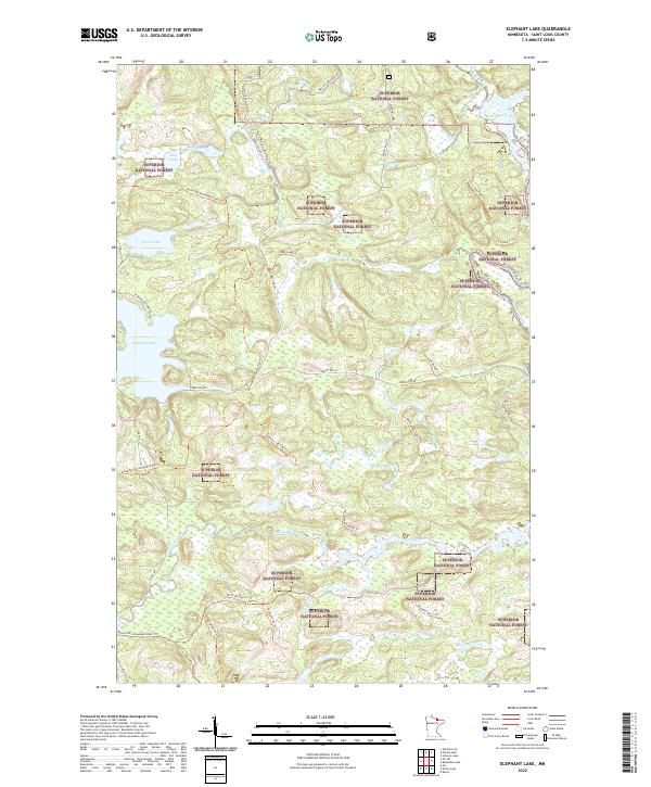
2022 Map of Elephant Lake
USGS Topo · Published 2022About this map
Superior National Forest dominates this northern Minnesota landscape, where a network of forest roads and specialized trails weaves through dense woodlands and wetlands. The central prominence of Elephant Lake and nearby Silver Lake provides a focal point for the regional topography, which is defined by water systems like the Pelican River and Vermilion River. Historically significant paths such as the David Dill-Arrowhead State Trl and various railroad-inflected routes, including the Rr Grade Spur Aa Trl, point to the area’s long-standing reliance on timber and natural resource transport. The naming of minor waterways like Bug Creek and Clear Cr reflects a landscape finely partitioned by the Public Land Survey System, as seen in the grid of township and range boundaries that overlay the wilderness.
Find a feature on this map
37 named features on this map. Tap any name to fly to it.
Don’t see what you’re looking for? This feature index may not catch every label — zoom into the map to look around manually.
Map Details
Editions of this 2022 Elephant Lake Map
This is the sole edition of this map. No revisions or reprints were ever made.
Other maps of this area

1954 · International Falls
USGS Topo · 1:250,000

1957 · International Falls
USGS Topo · 1:250,000

1958 · International Falls
USGS Topo · 1:250,000

1967 · Kabustasa Lake
USGS Topo · 1:24,000

1967 · Marion Lake
USGS Topo · 1:24,000

1967 · Elephant Lake
USGS Topo · 1:24,000
1967 · Buyck
USGS Topo · 1:24,000

1967 · Johnson Lake
USGS Topo · 1:24,000
1968 · Myrtle Lake
USGS Topo · 1:24,000

1968 · Ash River SE
USGS Topo · 1:24,000