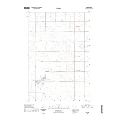
2020 Map of Elgin
USGS Topo · Published 2020About this map
Elgin serves as the focal point of this Grant County survey, anchored by a tight grid of residential streets such as S Main St and Dakota St S. The town's historical and communal identity is reflected in its high concentration of denominational burial grounds, including the Bethesda United Methodist Cem, Immanuel Lutheran Cem, and the Zion Cem. These sites, clustered near the town center, suggest a long-standing pattern of religious settlement and genealogy central to the community's development.
Find a feature on this map
38 named features on this map. Tap any name to fly to it.
Don’t see what you’re looking for? This feature index may not catch every label — zoom into the map to look around manually.
Map Details
Editions of this 2020 Elgin Map
This is the sole edition of this map. No revisions or reprints were ever made.
Other maps of this area

1938 · Heart Butte
USGS Topo · 1:48,000

1944 · Heart Butte
USGS Topo · 1:62,500

1954 · Bismarck
USGS Topo · 1:250,000

1958 · Bismarck
USGS Topo · 1:250,000

1972 · Leith
USGS Topo · 1:24,000

1972 · New Leipzig South
USGS Topo · 1:24,000

1972 · Sheep Creek Dam
USGS Topo · 1:24,000
1980 · Lake Tschida East
USGS Topo · 1:24,000

1980 · Heil
USGS Topo · 1:24,000

1980 · Crown Butte Creek SW
USGS Topo · 1:24,000