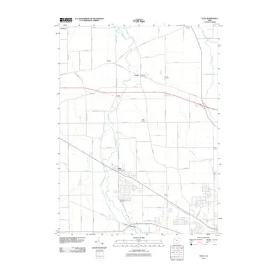
2010 Map of Elida
USGS Topo · Published 2010About this map
Elida and Allentown serve as the primary population centers in this rural Ohio landscape, where the Ottawa River meanders through agricultural fields and small woodlots. The map reveals a dense network of local history, most notably through its numerous family and community burial grounds such as Clerenger Cemetery, Carman Cemetery, and the Dutch Hollow Cemetery. The village of Gomer, situated near the Gomer Post Office, anchors the northern portion of the quadrangle alongside the historic W Lincoln Hwy.
Find a feature on this map
77 named features on this map. Tap any name to fly to it.
Don’t see what you’re looking for? This feature index may not catch every label — zoom into the map to look around manually.
Map Details
Editions of this 2010 Elida Map
This is the sole edition of this map. No revisions or reprints were ever made.
Other maps of this area

1906 · Lima
USGS Topo · 1:62,500

1906 · Columbus Grove
USGS Topo · 1:62,500

1908 · Columbus Grove
USGS Topo · 1:62,500

1911 · Spencerville
USGS Topo · 1:62,500

1911 · Delphos
USGS Topo · 1:62,500

1944 · Delphos
USGS Topo · 1:62,500

1944 · Spencerville
USGS Topo · 1:62,500

1953 · Muncie
USGS Topo · 1:250,000

1956 · Muncie
USGS Topo · 1:250,000
1960 · Columbus Grove
USGS Topo · 1:24,000