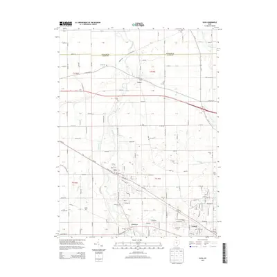
2013 Map of Elida
USGS Topo · Published 2013About this map
Ottawa River and its tributaries, including Pike Run, Honey Run, and Dug Run, define the drainage of this western Ohio landscape. The village of Elida serves as a central hub, with the residential and industrial outskirts of Lima emerging in the southeast corner. This area includes the University of Northwestern Ohio and reflects the steady development of Allen County's road network, featuring West Lincoln Highway and Oh-115. Rural heritage is preserved through numerous family and community burial grounds such as Hadding Cemetery and Ash Grove Cemetery. The map also identifies local agricultural operations like the G and Swine Farm near the Allentown area, illustrating the mix of academic, residential, and farming land uses at this time.
Find a feature on this map
161 named features on this map. Tap any name to fly to it.
Don’t see what you’re looking for? This feature index may not catch every label — zoom into the map to look around manually.
Map Details
Editions of this 2013 Elida Map
This is the sole edition of this map. No revisions or reprints were ever made.
Other maps of this area

1906 · Lima
USGS Topo · 1:62,500

1906 · Columbus Grove
USGS Topo · 1:62,500

1908 · Columbus Grove
USGS Topo · 1:62,500

1911 · Spencerville
USGS Topo · 1:62,500

1911 · Delphos
USGS Topo · 1:62,500

1944 · Delphos
USGS Topo · 1:62,500

1944 · Spencerville
USGS Topo · 1:62,500

1953 · Muncie
USGS Topo · 1:250,000

1956 · Muncie
USGS Topo · 1:250,000
1960 · Columbus Grove
USGS Topo · 1:24,000