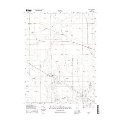
2016 Map of Elida
USGS Topo · Published 2016About this map
The Ottawa River meanders through Allen County, defining the agricultural landscape between the villages of Elida and Gomer. This 2016 survey highlights the expansion of Lima toward the northwest, where the University of Northwestern Ohio sits near the junction of several major transit corridors. The area's long-established rural character is preserved through numerous family and community burial grounds, including Greenlawn Cemetery and the Lutheran Cemetery in Elida, as well as the Ash Grove Cemetery to the east.
Find a feature on this map
128 named features on this map. Tap any name to fly to it.
Don’t see what you’re looking for? This feature index may not catch every label — zoom into the map to look around manually.
Map Details
Editions of this 2016 Elida Map
This is the sole edition of this map. No revisions or reprints were ever made.
Other maps of this area

1906 · Lima
USGS Topo · 1:62,500

1906 · Columbus Grove
USGS Topo · 1:62,500

1908 · Columbus Grove
USGS Topo · 1:62,500

1911 · Spencerville
USGS Topo · 1:62,500

1911 · Delphos
USGS Topo · 1:62,500

1944 · Delphos
USGS Topo · 1:62,500

1944 · Spencerville
USGS Topo · 1:62,500

1953 · Muncie
USGS Topo · 1:250,000

1956 · Muncie
USGS Topo · 1:250,000
1960 · Columbus Grove
USGS Topo · 1:24,000