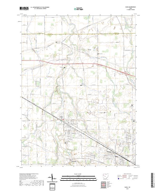
2023 Map of Elida
USGS Topo · Published 2023About this map
Ottawa River and its tributaries, including Pike Run and Dug Run, carve through the agricultural landscape of northern Allen County. This modern survey illustrates the development patterns of Elida, Gomer, and Allentown as they integrate with the expanding western edge of Lima. The map is particularly useful for genealogists, as it meticulously identifies numerous local burial grounds such as Greenlawn Cem, Salem Mennonite Cem, and Wesley Chapel Cem, which often serve as the primary markers of earlier community centers.
Find a feature on this map
119 named features on this map. Tap any name to fly to it.
Don’t see what you’re looking for? This feature index may not catch every label — zoom into the map to look around manually.
Map Details
Editions of this 2023 Elida Map
This is the sole edition of this map. No revisions or reprints were ever made.
Other maps of this area

1906 · Lima
USGS Topo · 1:62,500

1906 · Columbus Grove
USGS Topo · 1:62,500

1908 · Columbus Grove
USGS Topo · 1:62,500

1911 · Spencerville
USGS Topo · 1:62,500

1911 · Delphos
USGS Topo · 1:62,500

1944 · Delphos
USGS Topo · 1:62,500

1944 · Spencerville
USGS Topo · 1:62,500

1953 · Muncie
USGS Topo · 1:250,000

1956 · Muncie
USGS Topo · 1:250,000
1960 · Columbus Grove
USGS Topo · 1:24,000