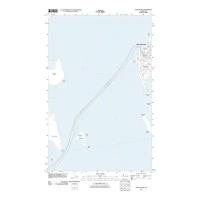
2011 Map of Eliza Island
USGS Topo · Published 2011About this map
Bellingham Bay serves as the central focal point of this coastal survey, where the maritime reaches of the Salish Sea meet the urban edges of Bellingham. To the east, the historic district of Fairhaven and the residential area of Edgemoor overlook the water, with Padden Creek Marine marking the industrial and recreational waterfront. The map captures the intricate marine geography of the area, from the narrow Hale Passage separating Lummi Island and Portage Island to the southern waters of Samish Bay.
Find a feature on this map
38 named features on this map. Tap any name to fly to it.
Don’t see what you’re looking for? This feature index may not catch every label — zoom into the map to look around manually.
Map Details
Editions of this 2011 Eliza Island Map
This is the sole edition of this map. No revisions or reprints were ever made.
Other maps of this area

1906 · Sumas
USGS Topo · 1:62,500

1907 · Blaine
USGS Topo · 1:62,500

1908 · Sumas
USGS Topo · 1:62,500

1918 · Samish Lake
USGS Topo · 1:62,500

1943 · Anacortes
USGS Topo · 1:62,500

1951 · Anacortes
USGS Topo · 1:62,500

1952 · Ferndale
USGS Topo · 1:24,000

1952 · Lummi Bay
USGS Topo · 1:24,000

1952 · Blaine
USGS Topo · 1:62,500

1954 · Bow
USGS Topo · 1:24,000