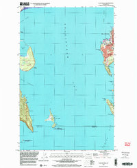
1998 Map of Eliza Island
USGS Topo · Published 2003About this map
Bellingham's shoreline and the protected waters of Bellingham Bay anchor this late-twentieth-century survey, revealing a landscape defined by the convergence of residential growth and island conservation. The eastern shore is densely characterized by the neighborhoods of Fairhaven and Edgemoor, where institutional landmarks like Fairhaven Middle Sch and recreational spaces such as Boulevard Park and Marine Park mark the urban fringe. Across the Hale Passage, the Lummi Indian Reservation occupies the heights of Lummi Island, terminating at Carter Point.
Find a feature on this map
39 named features on this map. Tap any name to fly to it.
Don’t see what you’re looking for? This feature index may not catch every label — zoom into the map to look around manually.
Map Details
Editions of this 1998 Eliza Island Map
This is the sole edition of this map. No revisions or reprints were ever made.
Other maps of this area

1906 · Sumas
USGS Topo · 1:62,500

1907 · Blaine
USGS Topo · 1:62,500

1908 · Sumas
USGS Topo · 1:62,500

1918 · Samish Lake
USGS Topo · 1:62,500

1943 · Anacortes
USGS Topo · 1:62,500

1951 · Anacortes
USGS Topo · 1:62,500

1952 · Ferndale
USGS Topo · 1:24,000

1952 · Lummi Bay
USGS Topo · 1:24,000

1952 · Blaine
USGS Topo · 1:62,500

1954 · Bow
USGS Topo · 1:24,000